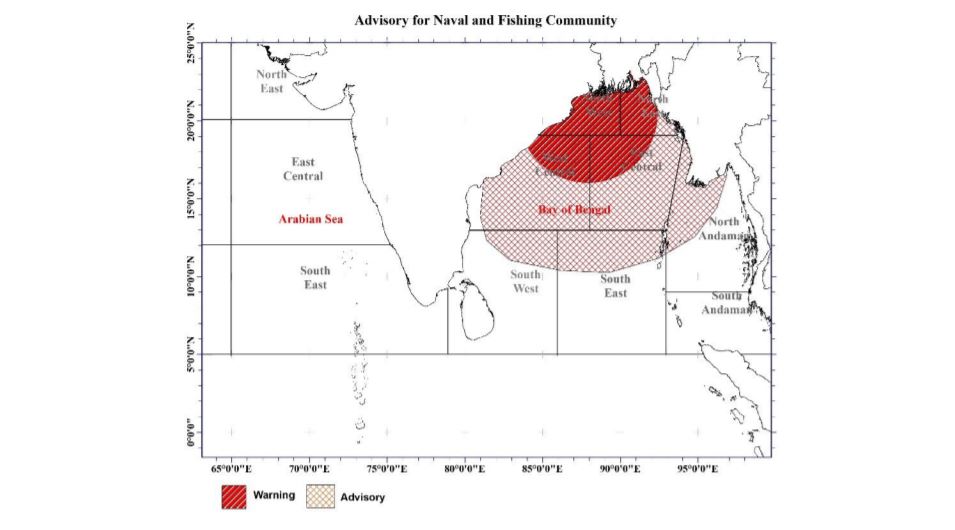
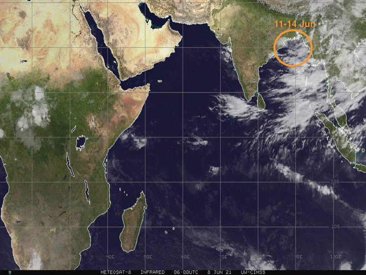
Low Pressure Area in the Bay of Bengal. Wind speed will be 50 kmph
A low-pressure area has formed over northwest Bay of Bengal and adjoining sea areas. It is Likely to further develop over the same region during next 24 hours and move west-northwestwards. Foreign weather forecasts predict the low pressure is expected become a depression before pushing into the India’s Odisha or West Bengal coast this weekend. No direct impact to Sri Lanka.
Showers or thundershowers will occur at times in Central and Sabaragamuwa provinces and fairly heavy falls about 50 mm can be expected at some places. Several spells of showers will occur in Western and North-Western provinces and in Galle and Matara districts.
Wind speed will be (30-40) kmph in the western slope of the Central hills, Northern, North-Central and North-Western provinces and in Hambantota and Trincomalee districts. The wind speed can be increased up to 50 kmph at times in these areas.
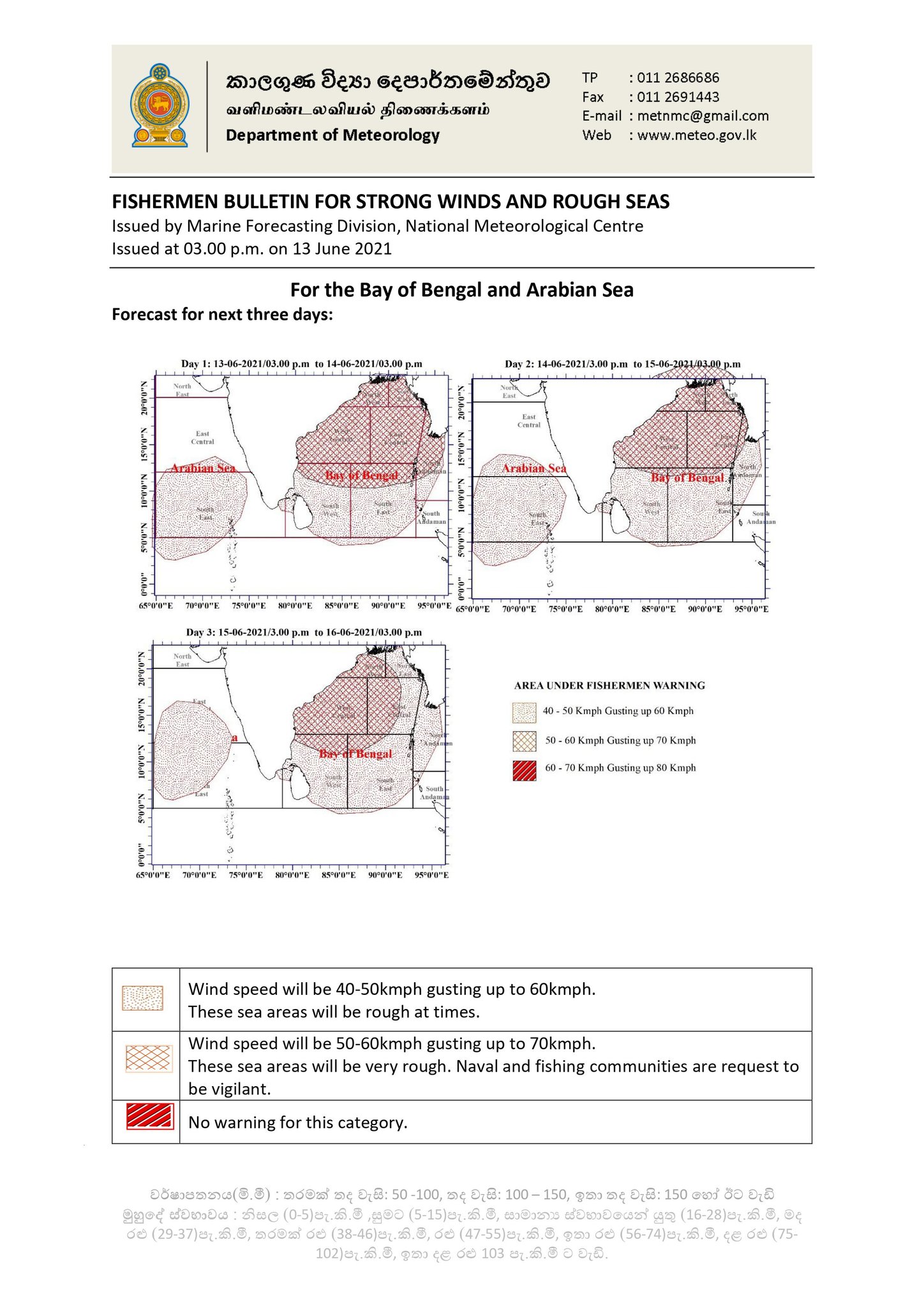
For the Sea area:
• Naval and fishing communities who are in above mentioned sea area are advised to be vigilant in this regard.
• Fishing and naval community are requested to be attentive regarding future advisories issued in this regard.
Showers or thundershowers will occur at times in Western and Sabaragamuwa provinces and in Galle, Matara, Nuwara-Eliya and Kandy districts. Fairly heavy falls about 50 mm can be expected at some places. Several spells of showers will occur in North-Western province. Showers or thundershowers will occur at a few places in Uva and Eastern provinces during the evening or night.
Wind speed will be (30-40) kmph in the western slope of the Central hills, Northern, North-Central and North-Western provinces and in Hambantota and Trincomalee districts. The wind speed can increase up to 50 kmph at times in these areas.