
Expect heavy rains above 100 mm and Strong Winds due to low pressure area in Bay of Bengal
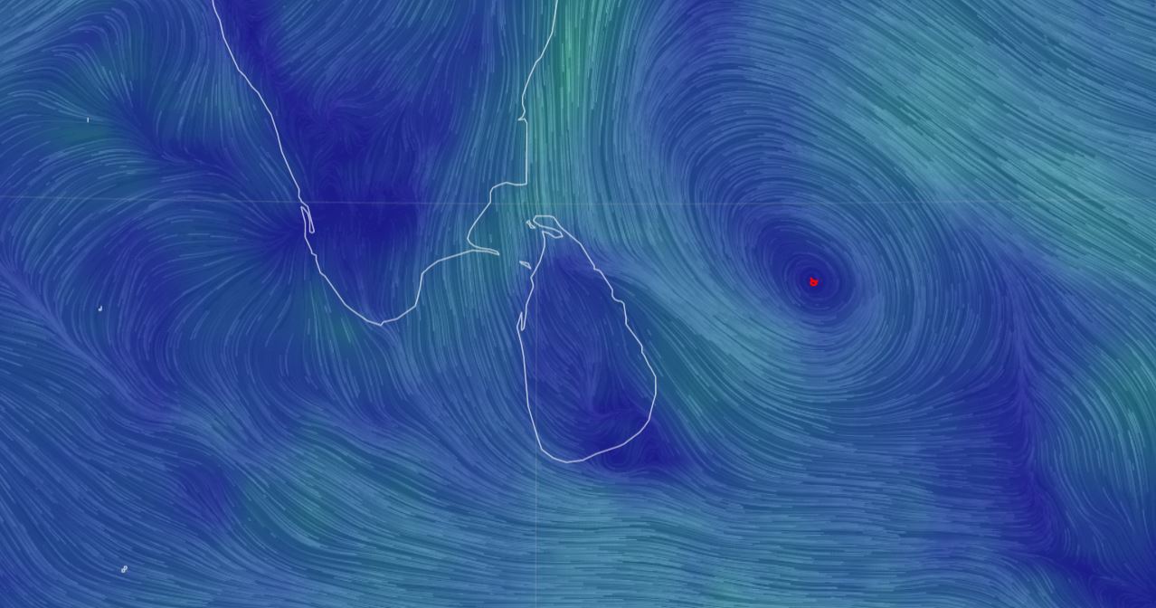
Prevailing Cyclonic Circulation over Bay of Bengal is expected to intensify in to a low pressure area. There are chances of intensification further of the possible system and movement towards Tamil Nadu Coast. Sri Lanka Department of Meteorology says the prevailing low-level atmospheric disturbance located to the south-east of Sri Lanka is expected to be intensified into a low pressure area during next few hours.
There can be very heavy showers or thundershowers, strong winds (40-50) kmph gusting up to 60 kmph associated with rough seas over the aforementioned sea area and the sea areas around the Island.
Naval and fishing communities out at sea over South-West Bay of Bengal, deep and shallow sea areas around the Island are advised to be vigilant in this regard during next few days.
Cloudy skies can be expected over the Sri Lanka.
Showers or thundershowers will occur at times in the most part of the island. Heavy rains about 100 mm can be expected at some places in Northern, North-Central, Eastern, Uva, Sabaragamuwa, Central and Southern provinces.
Fairly heavy showers above 75 mm can be expected at some places elsewhere.
There is a high probability of occurring flood situations in lowline flood prone areas of several rivers.
General public is kindly requested to take adequate precautions to minimize damages caused by temporary localized strong winds and lightning during thundershowers. (LankaXpress.com)