
Low-Pressure Area Bay of Bengal – Fairly heavy showers about 75 mm
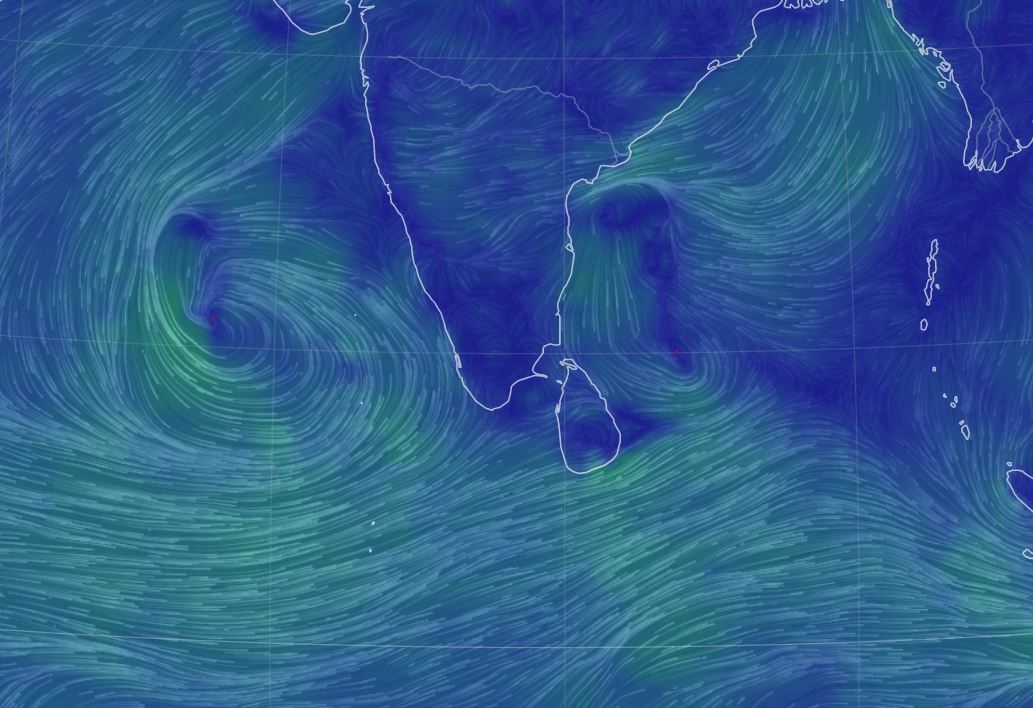
A Low-Pressure Area formed over North Andaman Sea and adjoining areas of south Andaman Sea & Southeast Bay of Bengal.
Showers or thundershowers will occur at times in Western, Sabaragamuwa, Central, North-Western and Northern provinces and in Galle and Matara districts.
Fairly heavy showers about 75 mm may be expected at some places in Western, Sabaragamuwa, Central and North-Western provinces and in Galle and Matara districts.
Showers or thundershowers will occur elsewhere over the Island during the afternoon or night.
A Low-Pressure Area formed over North Andaman Sea and adjoining areas of south Andaman Sea & Southeast Bay of Bengal.
It is very likely to move west-northwestwards and intensify into a Depression over same region around 22nd October. It is very likely to intensify into a Deep Depression on 23rd October and subsequently into a cyclonic storm by 24th October. Thereafter, it is likely to move gradually north-northeastwards and reach near West Bengal – Bangladesh coasts on 25th October.
Wind speeds will be (40-45) kmph and can increase up to 60 kmph in sea areas between (07N – 14 N) and between (90E – 100E).
Heavy showers or thundershowers and very rough or rough seas can also be expected in above sea areas.
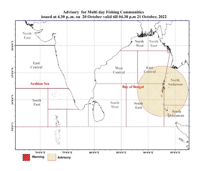
Actions Required:
• Naval and fishing communities are advised not to venture into the sea areas bounded by (10N-20N, 85E-100E) from 21st to 25th October.
• Those who are out at aforementioned sea regions are advised to return to coasts or moved to safer areas immediately.
• Fishing and naval community are requested to be attentive to future forecasts issued by the Department of Meteorology in this regard.
General public is kindly requested to take adequate precautions to minimize damages caused by temporary localized strong winds and lightning during thundershowers.