Cyclone ‘Arnab’ likely to intensify into very severe cyclonic storm; Sri Lanka to see increased rainfall
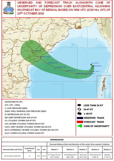
A depression over the east-central and adjoining southeast Bay of Bengal is expected to strengthen into Cyclone ‘Arnab’ and further intensify into a very severe cyclonic storm before reaching the Andhra Pradesh coast, according to the latest forecast from the India Meteorological Department (IMD).
The system was centred near 15.5°N latitude and 91.0°E longitude at 11.30 p.m. on October 24, and was moving at around 8 kmph. It was located about 860 km east-southeast of Visakhapatnam and 1,130 km east of Bapatla.
Cyclone Arnab forecast
The IMD forecasts that the system will initially move nearly southwards on October 25, intensifying into a deep depression, before gradually recurving towards the west-northwest.
It is then expected to:
- Become a cyclonic storm by the morning of October 26
- Intensify into a severe cyclonic storm around October 27
- Further strengthen into a very severe cyclonic storm
- Reach the west-central Bay of Bengal near the Andhra Pradesh coast around October 28
- Cross the Andhra Pradesh and Yanam coasts between Bapatla and Visakhapatnam by the forenoon of October 28
At landfall, the IMD forecasts maximum sustained winds of 115–125 kmph, gusting up to 140 kmph.
The IMD has issued cautionary signals at several ports along the Andhra Pradesh coast as the system approaches.
No direct impact expected on Sri Lanka
Sri Lanka’s Department of Meteorology says the system is not expected to have a direct impact on Sri Lanka.
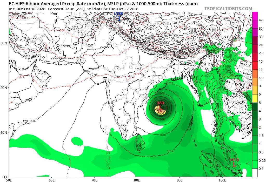
However, the associated wind flow extending across the island is expected to cause an increase in rainfall, particularly over southwestern Sri Lanka, during the next few days.
The Sri Lankan Meteorological Department forecasts showers or thundershowers at times in the Western, Sabaragamuwa, Southern, North-Western and Northern provinces, as well as Kandy, Nuwara Eliya and Anuradhapura districts.
Heavy rainfall exceeding 100 mm is possible at some locations in these areas.
Showers or thundershowers are also expected at several places in the Uva Province and Ampara and Batticaloa districts after 1.00 p.m.
Fairly strong winds of around 40–50 kmph may occur at times over the western slopes of the Central Hills, Northern, North Central and North Western provinces, as well as Trincomalee, Hambantota and Matale districts.
The public has been advised to take precautions against temporary strong winds and lightning during thunderstorms.