
Possible Cyclone “Arnab” Developing in Bay of Bengal: No Direct Impact Expected on Sri Lanka
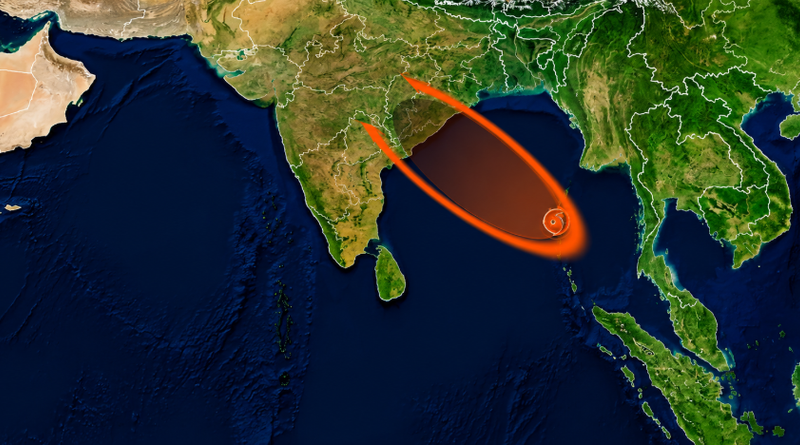
COLOMBO, Sri Lanka — September 20, 2026 — (LankaXpress.com) A developing weather system over the Andaman Sea and Bay of Bengal is being closely monitored as it is expected to strengthen and move west-northwestwards in the coming days.
Some weather reports and social media discussions have referred to the possible future cyclone as “Arnab.” However, this name has not been officially confirmed at this stage.
More importantly, there is currently no official confirmation that the system will develop into a cyclone at all. India’s Meteorological Department is currently forecasting the development and gradual intensification of a low-pressure system, with the system expected to move towards the south Odisha–north Andhra Pradesh coast.
Sri Lanka not expected to face a direct impact
For Sri Lanka, the latest weather information indicates that there is no direct impact expected from this developing system.
However, its influence could lead to rough seas, stronger winds and increased rainfall around parts of Sri Lanka and the surrounding seas.
The Sri Lanka Department of Meteorology has warned that sea areas from Matara to Pottuvil via Hambantota could experience rough conditions at times, with strong gusty winds reaching around 50–60 kmph.
Wave heights could increase to around 2.0–2.5 metres in sea areas extending from Puttalam to Pottuvil via Colombo, Galle and Matara.
Fishing and naval communities operating in these areas have been advised to remain vigilant.
Heavy rain forecast for Sri Lanka
Although Sri Lanka is not expected to be directly affected by the developing Bay of Bengal system, rainfall is expected to increase over several parts of the country.
The Department of Meteorology forecasts showers or thundershowers at times in the Western, Sabaragamuwa and North-Western provinces, as well as Galle, Matara, Kandy and Nuwara Eliya districts.
Heavy rainfall of around 100 mm or more is possible at some locations in the Western and Sabaragamuwa provinces and in Kandy and Nuwara Eliya districts.
Showers or thundershowers are also expected in several areas of Uva and Northern provinces and in Batticaloa and Ampara districts after 2 p.m.
Fairly strong winds of around 30–40 kmph are expected at times over the western slopes of the Central Hills, North Central and North Western provinces, as well as in Trincomalee, Hambantota and Matale districts.
Bay of Bengal system moving towards India
The weather system originated from a cyclonic circulation that moved westwards from the Thailand region and emerged over the North Andaman Sea and surrounding areas.
The IMD has forecast that the resulting low-pressure area will gradually intensify while moving west-northwestwards towards south Odisha and north Andhra Pradesh during the following days.
India’s eastern coast is therefore expected to experience increasingly unsettled weather, with heavy rainfall and strong winds forecast in parts of Odisha and Andhra Pradesh. The IMD has issued warnings for very heavy and extremely heavy rainfall in Odisha during the coming days. (Mausam)
For Sri Lanka, the immediate concern is not a direct cyclone strike, but the potential for heavy rain, gusty winds and rough seas as the wider weather system develops over the Bay of Bengal.
People involved in fishing, naval and other marine activities are advised to follow the latest official warnings and avoid unnecessary risks in affected sea areas.
